
A guide to coastal geomorphology and marina infrastructure: an introduction to waterfront ecosystems
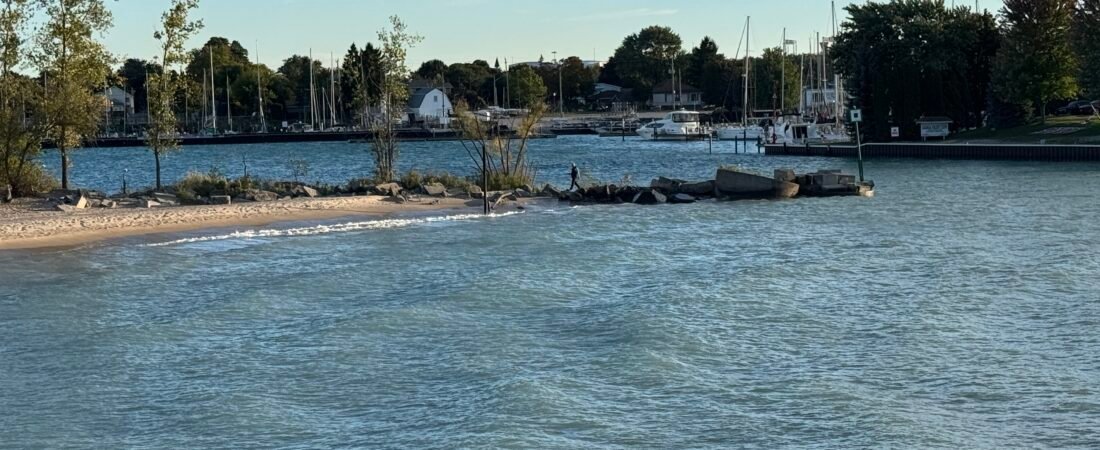
The interfaces between coastal and river areas are some of the most dynamically complicated ecosystems and civil engineering regions in today’s geography. As shown in this clear view taken in the afternoon (IMG_0706.JPG), the place where open water meets engineered shorelines and maritime infrastructure provides a striking example of how humans interact with natural water bodies. The image shows a well-balanced maritime landscape, with a naturally formed sandy spit, rigid breakwater barriers made up of large concrete and rock pieces, and in the background a busy marina filled with boats moored there. To understand such areas it is necessary to carry out a multifaceted analysis that combines environmental science, civil engineering, and urban waterfront planning.
In the foreground and in the middle distance, the relationship between natural sediment deposition and artificial shoreline protection is clearly visible. The small sandy beach, surrounded by low vegetation and a few young deciduous trees, functions as an area of dynamic deposition where the action of waves constantly alters the shoreline. Next to this soft engineering feature, a single person is seen walking along a rough barrier composed of angular rocks and concrete blocks that extend into the channel. This man-made breakwater has an important structural function: it reduces the energy of incoming waves, protects the inner cove from serious erosion, and keeps the basin calm so that the recreational boats moored in the distance are safe.
Beyond the immediate protection of the shoreline, the background shows a dense cluster of marine infrastructure, such as yacht masts, floating docks, and waterfront properties that shape the local economy and recreational lifestyle. Marinas are not simply places where boats are parked; they are complex socio-economic hubs that need strict environmental management in order to prevent fuel runoff, control wake erosion, and preserve local aquatic habitats. The clear, sunlit water indicates a healthy aquatic ecosystem, while the distant tree-lined horizon shows how suburban development is integrated with the natural boundaries of the water.
This article will look in depth at the mechanical and ecological characteristics that govern these coastal areas. We will study how civil engineers design breakwaters so that they can withstand severe weather without disrupting the natural flow of sediment, look at the ecological importance of transitional sandbars, and examine the sustainable management practices needed to ensure that modern marinas continue to thrive. By examining these various aspects, we obtain a full understanding of how communities can sustainably design, protect, and make use of their most valuable aquatic resources.
Riparian Buffers and Subsurface Hydrology: Protecting Shoreline Integrity
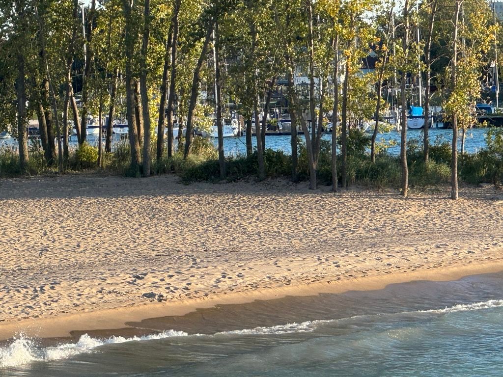
Building on the first examination of the sandy beach interface, a more in-depth look at the row of mature deciduous trees shows that they play a vital role as a riparian buffer zone. As is clearly shown in IMG_0707.JPG, this thick strip of vegetation which runs alongside the shoreline is not just a pleasing background feature; it functions as an active biological filtration system and acts as a structural support for the coastal ecosystem. The wide network of roots of these trees—mainly species that can tolerate moisture, such as cottonwoods and willows—extends beneath the sandy soil and provides the necessary tensile strength to stop rapid erosion of the shoreline during periods of high wind and high water.
From a hydrological point of view, this riparian area acts as an important transitional zone between the terrestrial urban area and the aquatic environment of the marina in the background. Whenever it rains, surface runoff carrying sediment, organic waste, and possible urban pollutants flows towards the water. The closely packed root systems and the deep layer of litter on the forest floor function like a porous sponge, reducing the speed of the surface water and enabling particulate matter to settle before it gets into the open channel. Moreover, the fast-growing trees carry out biological uptake of excess nutrients, particularly nitrogen and phosphorus, thus effectively avoiding harmful algal blooms in the neighbouring yacht basin.
In addition to managing water quality, this canopy forms a complicated microclimate that promotes local biodiversity. The shade provided by the mature trees controls both soil and water temperatures along the shore, producing suitable conditions for spawning and rearing of native aquatic species. At the same time, the thick foliage offers essential nesting sites and stops for migrating birds, setting up a flourishing ecological corridor within the area of recreational human development.
In the end, it is essential to preserve such well-developed riparian strips for municipal management of waterfront areas. In the absence of these natural vegetative barriers, wave action and uncontrolled runoff would quickly damage the coastline, undermining both its aesthetic value and the structural safety of the nearby maritime facilities. Viewing trees and natural shorelines as part of civil infrastructure ensures long-term environmental stability.
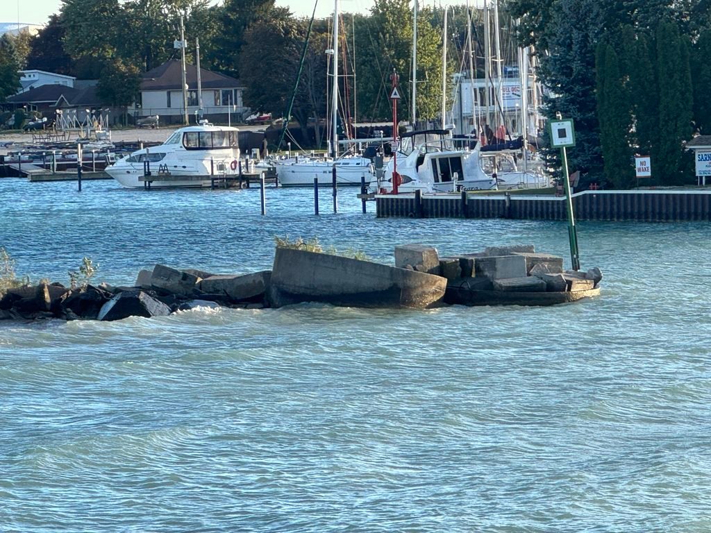
Ensuring channel safety and structural stability means that, beyond relying on natural ecological buffers, extensive civil engineering measures must be put in place. As can be seen in IMG_0708.JPG, the entrance to a protected harbour makes use of strong wave attenuation facilities, these being a heavy breakwater made up of interlocking concrete modules, precast blocks, and riprap stones. This barrier is placed at the mouth of the waterway in such a way as to stop the high-energy swells from the open sea, breaking up the kinetic energy of the waves so that they do not enter the quiet harbour basin where recreational yachts and motorboats are moored.
Along with the physical breakwater there is also a full system of navigation and safety signage which is necessary for the control of traffic in the waterway. On the breakwater itself there is a tall green channel marker (a lateral port-hand beacon) which directs vessels safely along the intended fairway and helps to avoid them running aground on hidden hazards. In the background, along the marina wall, there are regulatory signs such as “NO WAKE” which impose strict speed limits. By keeping vessels moving at a low speed, the wakes caused by the boats are reduced, thus protecting the fixed docks, avoiding collisions between hulls, and preventing erosion of the shoreline along the fragile earth banks.
Moreover, in the background the corrugated steel sheet piling is seen acting as a vertical bulkhead wall. This structural seawall holds back the soil on the land side, stops serious bank slumping, and provides secure mooring points for bigger vessels. The combination of concrete breakwaters, clear navigational aids, and solid seawall engineering together forms a complete infrastructure ecosystem, guaranteeing safe maritime travel and long-term harbour protection.
Conclusion: Megastructures, Maritime Safety, and the Synergy of Waterfront Integration
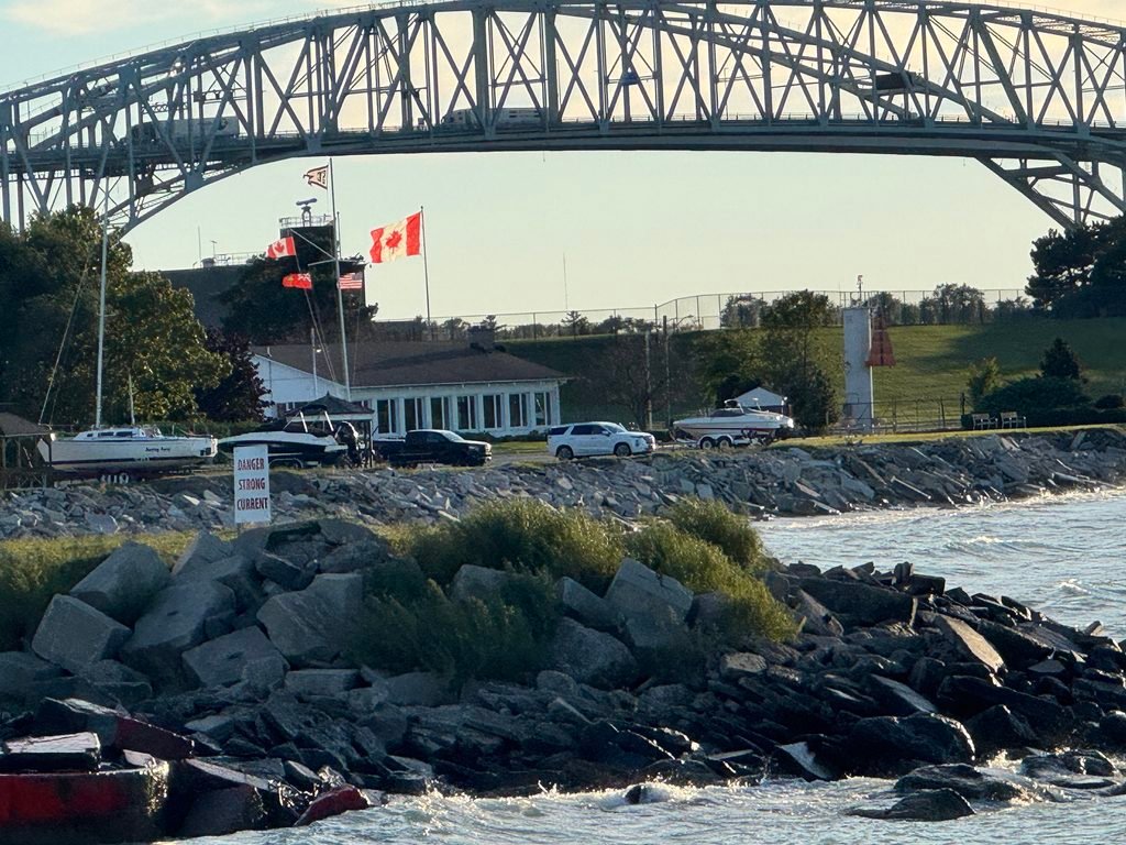
As our detailed examination of this evolving aquatic ecosystem comes to an end, the viewpoint shown in IMG_0709.JPG brings together the key aspects of heavy civil infrastructure, national identity, and coastal management. In the upper part of the image, a huge steel truss bridge—one that looks similar to the Blue Water Bridge linking international borders—crosses the waterway and represents the important trade routes, transport links, and areas of connectivity that are central to today’s geography. Below this great engineering structure, the waterfront area smoothly combines community facilities, navigational warnings, and protective barriers.
In the middle distance, a yacht club or maritime facility is displaying Canadian flags, with a number of boats moored alongside it, some vehicles parked nearby, and a clear white lighthouse tower visible. Importantly, a warning sign with the message “DANGER STRONG CURRENT” is fixed among the large stones of the rocky riprap shoreline, warning both walkers and boat operators of the strong hydraulic forces present in the channel. These strong currents are caused by the narrow shape of the river and the effects of wind, and as a result, the heavy armor stone breakwaters seen in the foreground are needed to take in wave energy and prevent the shoreline from suffering progressive erosion.
In the end, this final view shows the careful balance that must be achieved in modern coastal planning. Whether it be large interstate bridges and protective breakwaters or environmental safety signs and the preservation of the riparian zone, effective waterfronts rely on multi-disciplinary engineering. By taking account of natural hazards and making use of strong structural and ecological protections, communities can secure the long-term safety, economic strength, and aesthetic quality of their common aquatic boundaries.
Article Reference & Credits
Publisher & Media Owner: Curated Scope (https://curatedscope.com/)
Content Creator / Author: Curated Scope
Photography Credits: All photographs and visual media featured in this article were captured by Curated Scope and are protected under copyright.
Licensing & Usage: No part of this text or image content may be reproduced, republished, or redistributed without explicit written permission and proper source attribution back to Curated Scope